Newman Surveying was approached by a private client to undertake a topographical survey for a potential planning application. From initial contact, a preliminary site visit was arranged to meet the client on site. This allowed us to look at the site and the extent of the land to be surveyed. The site meeting allows us to offer a personal approach and understand the clients requirements from the outset.
This helps ensure no delays in delivering the required outcome and intention of the survey. Once our fee proposal was accepted and timelines agreed our experienced land surveyors visited site to collect the site data from which the drawings will be produced.
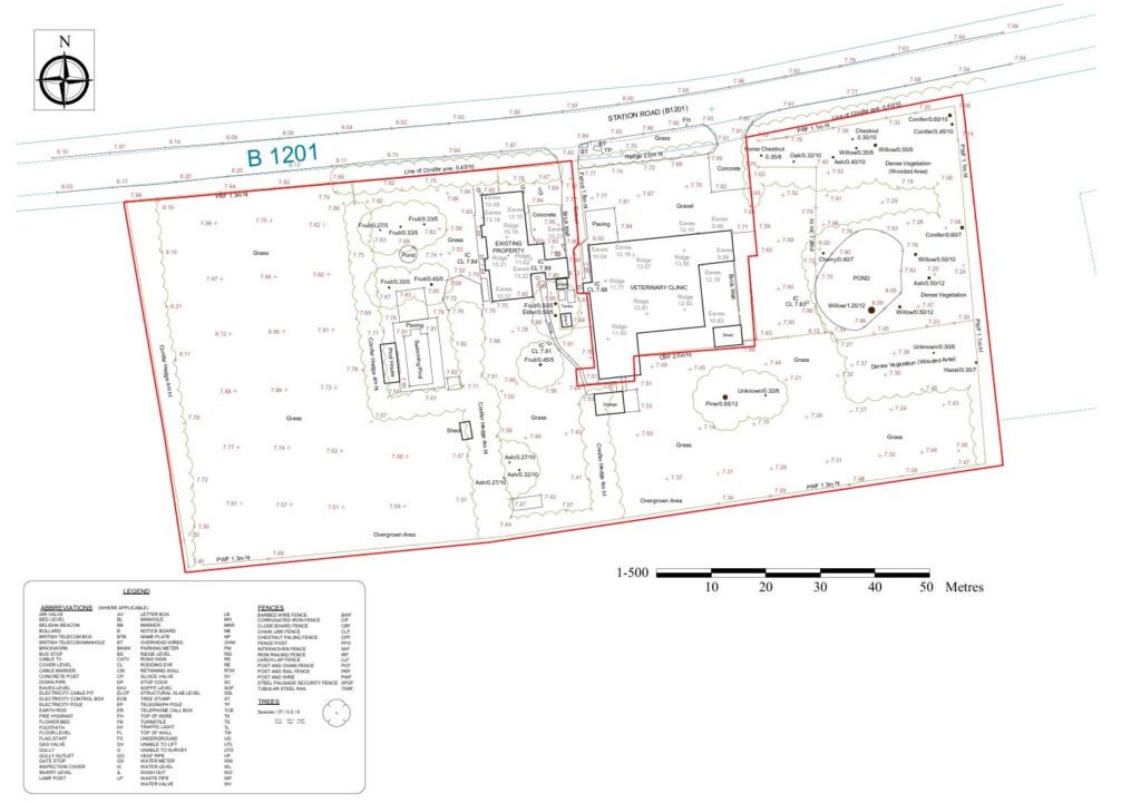
Using Topcon GPS and Leica total stations, all relevant features on the site was captured including spot levels throughout, trees, boundary features as well as building outlines and ridge and eave heights of neighbouring properties. Following the collection of the site data we then draw the plans on computer software which allows us to send both pdf and dwg files to the client. Sending the drawings in dwg files allows the architects working on the project to easily open and use our plans to design a scheme.